 Purdue University - Extension - Forestry and Natural Resources
Got Nature? Blog
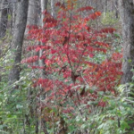 Winged burning bush, winged euonymus, or simply burning bush (Euonymus alatus) is a medium-sized deciduous shrub native to China, Japan and Korea but is widely planted in the United States. Winged burning bush has been planted in the US since the 1860s, primarily as an ornamental shrub due to its bright red fall foliage. Reports of this species escaping cultivation and establishing in natural areas, such as woodlands, prairies and other uncultivated areas, emerged in the 1970s in the Northeast and Midwest US. The species is now considered invasive in most of the eastern US, including Indiana.
Invasive Plant Series: Winged Burning Bush is an 8-page publication written by experts Brian Beheler, farm manager, Don Carlson, forester, Lenny Farlee, sustaining hardwood extension specialist and Ron Rathfon, regional extension forester SIPAC. In this publication, you can learn about the identification, distribution, impact, management and control of this deciduous shrub found in Indiana hardwood forests. For more information check out the Burning Bush Video.
Resources
Report Invasive Species, Purdue Agriculture & Indiana Invasive Species Council
The GLEDN Phone App – Great Lakes Early Detection Network
EDDMaps – Early Detection and Distribution Mapping System (Report Invasives)
Cooperative Invasive Species Management Area (CISMA)
Indiana Department of Natural Resources: Invasive Species
Indiana Invasive Species Council
Burning Bush Video, video, The Education Store, Purdue Extension resource center
What Nurseries Need to Know About the Invasive Species Regulation, The Education Store
Invasive plants: impact on environment and people, The Education Store
Invasive Plant Species: Oriental Bittersweet, The Education Store
Invasive Plant Species: Callery Pear, The Education Store
Invasive Plant Species: Wintercreeper, The Education Store
Lenny Farlee, Extension Forester
Purdue University Department of Forestry and Natural Resources
ArcGIS.com
Unmanned Aerial Systems and Burn Management Strategies
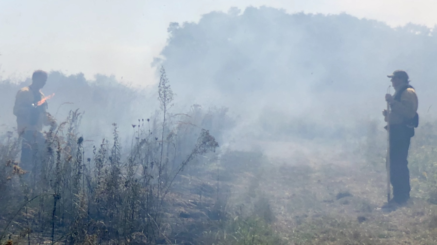
On September 19, 2019 a controlled burn was conducted on the Doak grassland and forest property, owned and managed by the Department of Forestry and Natural Resources at Purdue University. Burn events such as this one present a unique opportunity to demonstrate how UAS can be utilized as an effective tool to both monitor the burn events in real time, but also to effectively gather data before and after the burn to map and better manage vegetation. This collection of maps, videos, and images provide a narrative on how UAS can be used as an effective tool in controlled burn management practices. Beyond controlled burns, the story should demonstrate how UAS can be used to better monitor and inventory other disturbance events, whether they are planned or unexpected.
A Collaborative Effort
The data collected for this event represents a collaborative effort between multiple colleges at Purdue University and private industry. Employees with Purdue Forestry and Natural Resources (College of Agriculture) performed and managed the burn while data collection for the pre and post-burn mapping was conducted by student researchers and pilots from the Purdue School of Aviation and Transportation Technology (SATT; Polytechnic Institute). Peter Menet and Chris Johnson from MenetAero provided aerial monitoring support throughout the controlled burn. A total of three different aircraft were used during this event. The SATT student pilots deployed a C-Astral Bramor PPX equipped with a MicaSense Altum 6 band multispectral sensor at 121 meters before and after the event for mapping purposes. MenetAero deployed a C-Astral C4Eye to monitor the burn in real time using EO/Thermal IR video with real time geographic coordinates at 121 meters while SATT students monitored the burn with a DJI M600 equipped with a Zenmuse XT2 sensor at lower altitudes.
Monitoring the Burn:
The nimble nature of UAS makes them ideally suited to deploy rapidly, and into tight situations otherwise too dangerous for ground crews and manned aircraft. Add to this the aerial perspective offered by UAS via real-time video feed, and you have the perfect platform to assist in hazard events such as fire. The real-time video feed allows the UAS pilot and crew to communicate with ground-based fire crews, providing information on potential hazards and overall fire behavior patterns. For this aerial perspective to be effective, however, the video needs to have geospatial context so what the UAS operator is seeing is effectively communicated to ground-based fire crews. Full-Motion-Video, or video that has metadata with geospatial coordinate information, is a game changer in this regard. The video below shows how software such as Remote Geosystems Line Vision Ultimate can place video in a geospatial context. The video below is being played after the flight, but Pete Menet from MenetAero had the video live streaming to his Ground Station during the flight and was able to effectively serve as an ‘eye in the sky’ to provide real time information to ground based crews. This was all done in a controlled burn, but this same technology and method is used by MenetAero during Wild Fire Events where MenetAero provides UAS services as a contractor with the U.S. Department of Interior. Peter Menet and the MenetAero crew were kind enough to donate their services and time to the controlled burn event this day as part of a collaborative research effort between industry and Purdue.
A Before and After Comparison
Prior to recent advances in UAS technology, gathering imagery at sub-centimeter accuracy and resolution immediately before and after a planned burn event would prove difficult at best. The PPK technology on the C-Astral PPX allowed us to conduct the flights without the need to layout and survey ground control markers, but still achieve centimeter level accuracy by post-processing our data with a Continuously Operating Reference Stations in close proximity. Without UAS, getting satellite data within this time frame would have been pretty much impossible, and getting a manned aircraft to do this prohibitively expensive.
Making Sense of it all through Classification Analysis
Pre-Burn Land Cover Classification
When we think of disturbance events, we often think of the unplanned ones – fire, ice storms, wind storms, floods, etc. But what about planed disturbances such as a controlled burn, or a timber harvest operation? In the case of a planned disturbance, we have the ability to inventory land cover immediately before an event, and then with classification methods, quantify that land cover. Land Use/Cover classification methods are nothing new, and go back to the very beginnings of GIS/Remote Sensing, but new here is the ability to deploy a UAS to get this data in a way that is accurate and precise enough to classify down to resolutions of several square centimeters. Add to that the imagery was gathered less than an hour before the burn and you have some amazing potential for forestland management.
*Thank you to ArcGIS.com for sharing the great work of our FNR specialists as they continue to “strengthen lives and livelihoods” here in Indiana and around the world.
Resources
Unmanned Aerial Systems and Burn Management Strategies, Unmanned Aerial Systems and Burn Management Strategies webpage
Effective Firebreaks for Safe Use of Prescribed Fire, Got Nature? Blog, Purdue University Forestry and Natural Resources Extension
Prescribed fire: 6 things to consider before you ignite, Got Nature? Blog
Renovating native warm-season grass stands for wildlife: A Land Manager’s Guide, The Education Store, Purdue Extension resource center
Calibrating a No-Till Drill for Conservation Plantings and Wildlife Food Plots, The Education Store
Jarred Brooke, Extension Wildlife Specialist
Purdue Department of Forestry and Natural Resources
Purdue Landscape Report: When was the last time you really looked at your trees? It’s all too easy to just  enjoy their cool shade and the sound of their leaves, but if you don’t know what to look for you could miss deadly diseases or dastardly demons lurking in their leaves and branches. A quick check can help you stop a problem before it kills your tree or your local forest!
National Tree Check Month is the perfect time to make sure your tree is in tip-top shape! Our checklist will help you spot early warning signs of native pests and pathogens and invasive pests like Asian longhorned beetle, spotted lanternfly, and sudden oak death. You can stop invasive pests in their tracks by reporting them if you see them.
Is your tree healthy and normal?
Start by making sure you know the type of tree you have. Is it a deciduous tree like an oak or maple? Or is it an evergreen that like a spruce or a pine? Don’t worry about exactly what species it is. It’s enough for you to have a general sense of what the tree should look like when it’s healthy.
Check the leaves
- Are the leaves yellow, red or brown?
- Are they spotted or discolored?
- Do the leaves look distorted or disfigured?
- Is there a sticky liquid on the leaves?
- Do the leaves appear wet, or give off a foul odor?
- Are leaves missing?
- Are parts of the leaves chewed?
Check the trunk and branches
- Are there holes or splits in the trunk or branches?
- Is the bark peeling from a tree that shouldn’t shed its bark?
- Are there tunnels or unusual patterns under the bark?
- Is there sawdust on or under the tree?
- Is there sap oozing down the tree?
- Does the sap have a bad odor?
- Do sticky drops fall on you when you stand under the tree? You might have spotted lanternfly. Please report it right away!
Now what? If you answered YES to any of the questions above, there’s a good chance something is wrong. To decide if and how you should treat or report the problem, you’ll need to have a tentative diagnosis. Luckily, there are many ways to get one!
Know the tree species? Use the Purdue Tree Doctor to get a diagnosis and a recommendation on whether treating or reporting is needed. This app allows you to flip through photos of problem plagued leaves, branches and trunks to help you rapidly identify the problem. If you have an invasive pest, it will guide you how to report it.
Don’t know the tree species and still need help? Reach out to local experts. We’re happy to help!
- Purdue Cooperative Extension Service (https://extension.purdue.edu/) can answer your questions or direct you to a local tree care professional with the right expertise.
- Contact an arborist who can give you an assessment of your tree and specific treatment recommendations (https://www.treesaregood.org/findanarborist).
Confused but think something is TERRIBLY WRONG? Contact Purdue’s Exotic Forest Pest Educator, report online, or call 1-866-NOEXOTIC.
Resources:
Trees and Storms: Understanding Damage, Risk and Recovery – Got Nature? Blog, Purdue Extension – FNR
Why Is My Tree Dying? – Got Nature? Blog, Purdue Extension – Forestry and Natural Resources
Caring for storm-damaged trees/How to Acidify Soil in the Yard, In the Grow, Purdue Extension
Tree Risk Management, The Education Store
Mechanical Damage to Trees: Mowing and Maintenance Equipment, The Education Store
Tree Installation: Process and Practices, The Education Store
Tree Planting Part 1 & Tree Planting Part 2, videos, The Education Store
The Invasive Terrestrial Plant Rule was signed by Governor Holcomb and published on March 18, 2019. the rule goes into effect 30 days after publishing, so it will be effective in April.
The Rule States that a person must not:
- sell, offer or grow for sale, gift, barter, exchange, or distribute a species;
- transport or transfer a species;
- introduce a species
with respect to the 44 invasive plant species (see full list in the Landscape Report).
Note: Selling, offering, distributing and transporting doesn’t go into effect until April of 2020, so nurseries will have some time to sell down their stock. This is an important component of the rule to minimize economic loss to nurseries that grow and/or sell the few commercially available species that are on the list. Currently there is no mandate to eradicate existing plantings in nurseries, landscapes, or forested areas
To learn more about what an invasive species is, what damage they do, what Indiana is doing, and more please read the Landscape Report, Terrestrial Invasive Species Rule Signed by Indiana Governor.
Resources
Mile-a-Minute Invasive Vine Found Indiana, Got Nature? Blog
Invasive plants: impact on environment and people, Purdue Extension The Education Store
Invasive Plant Species in Hardwood Tree Plantations, The Education Store
Invasive Plant Species: Callery Pear, Purdue Extension The Education Store
Invasive Plant Species: Wintercreeper, Purdue Extension The Education Store
Invasive Plant Species Oriental Bittersweet, Purdue Extension The Education Store
Report Invasive Species, Purdue Invasive Species
The GLEDN Phone App – Great Lakes Early Detection Network
EDDMaps – Early Detection and Distribution Mapping System (Report Invasives)
Cooperative Invasive Species Management Area (CISMA)
Indiana Department of Natural Resources: Invasive Species
Indiana Invasive Species Council
Indiana Department of Natural Resources (IDNR)
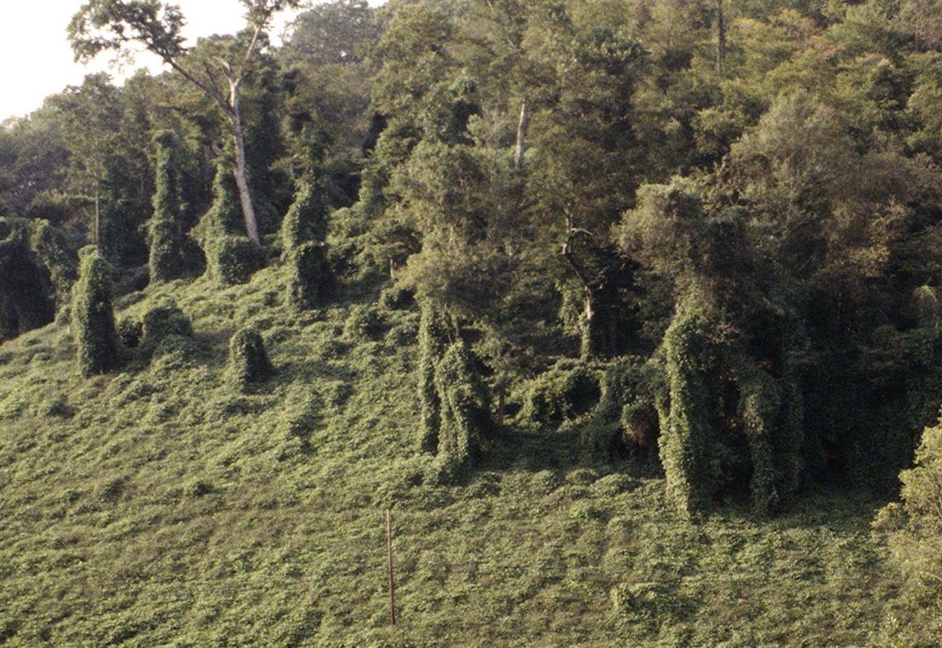
(Figure 1) Mile-a-minute vine grows more than 25 feet in height in one growing season, overtopping shrubs, small trees and growing up forest edges. Image by: USDA APHIS PPQ Archive, USDA APHIS PPQ, Bugwood.org
Preventing the establishment of new invasive species is priority number one and the best expenditure of limited resources in an invasive species management program. Next in priority is early detection of and rapid response (EDRR) to the first report of a new invasion. Stopping invasive species from entering or, next best, at their initial point of introduction saves the incalculable costs later-on associated with rapidly spreading, all-consuming invasive species populations. The verification of a report of mile-a-minute vine (Persicaria perfoliata) on a property in Monroe County, Indiana on May 14, 2018 sets a historical precedence demonstrating a growing capability of detecting and reporting new invaders. The population was very small at this spot and had apparently been sprayed by a homeowner with herbicide, not necessarily to kill the mile-a-minute, but likely to kill the companion multiflora rose.
Our hope is that this is the only instance of mile-a-minute vine in Indiana. There is a significant probability that it is not! In the coming months, a more thorough survey of this property and surrounding area will be conducted to look for more of the vine. But now Indiana stands on high alert as natural resource professionals keep a look out for more of this highly-invasive pest. However, there are too few professionals with eyes on the landscape. The more eyes trained to identify the very distinct characteristics of mile-a-minute, the higher the chance of us catching it before it explodes across the landscape, wreaking havoc and mayhem in our forests and fields, wildlife habitat and mushroom hunting and birding grounds.

(Figure 2) The leaves are simple, alternate, light green and a nearly perfect triangle shape. Image by: Leslie J. Mehrhoff, University of Connecticut, Bugwood.org
All landowners, land stewards, and nature lovers are needed to be additional eyes looking for this insidious threat this summer and in coming years. Please take a moment to learn its identifying characteristics. If you think you have found it, please report it on EDDMapS (Early Detection & Distribution Mapping System) or from your smart phone on the GLEDN (Great Lakes Early Detection Network) app. If you are unsure if you are correctly identifying it, please contact a forester or other natural resource professional for confirmation or just report it in EDDMapS or the GLEDN app, along with photos, and a professional in your area will verify its identification before it actually gets posted.
Mile-a-minute identification:
Mile-a-minute vine is a member of the buckwheat family, Polygonaceae. Although its common name exaggerates its growth potential, this annual vine can grow as much as 6 inches a day and can reach heights of more than 25 feet within the growing season. It forms very dense, tangled mats, growing over shrubs, small trees and up the sides of forest edges (Fig. 1). The leaves are simple, alternate, light green and a nearly perfect triangle shape (Fig. 2). The delicately narrow, green to red-tinted stems, and the petiole (leaf stem) and midrib on the underside of the leaves are armed with small, stiff, recurved barbs (Fig. 3). Small, cup- or saucer-shaped leaf structures, called ocreae, encircle the stem at each node (Fig. 4). Clusters of small white, rather inconspicuous, flowers emerge from the ocreae. Flowers develop into clusters of deep, iridescent blue berry-like fruits, approximately 5 mm in diameter, each fruit containing a single black or reddish-black hard seed, called an achene. Seeds are dispersed by birds and mammals, including chipmunks, squirrels and deer, which eat the fruit. Floodwaters facilitate long distance dispersal of seed.
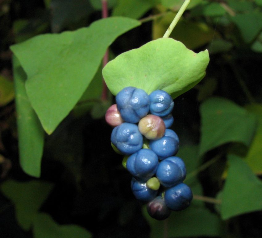
(Figure 4) Small, cup- or saucer-shaped leaf structures, called ocreae, encircle the stem at each node. Flowers emerge from the ocreae and develop into clusters of deep, iridescent blueberry like fruits. Image by: Leslie J. Mehrhoff, University of Connecticut, Bugwood.org
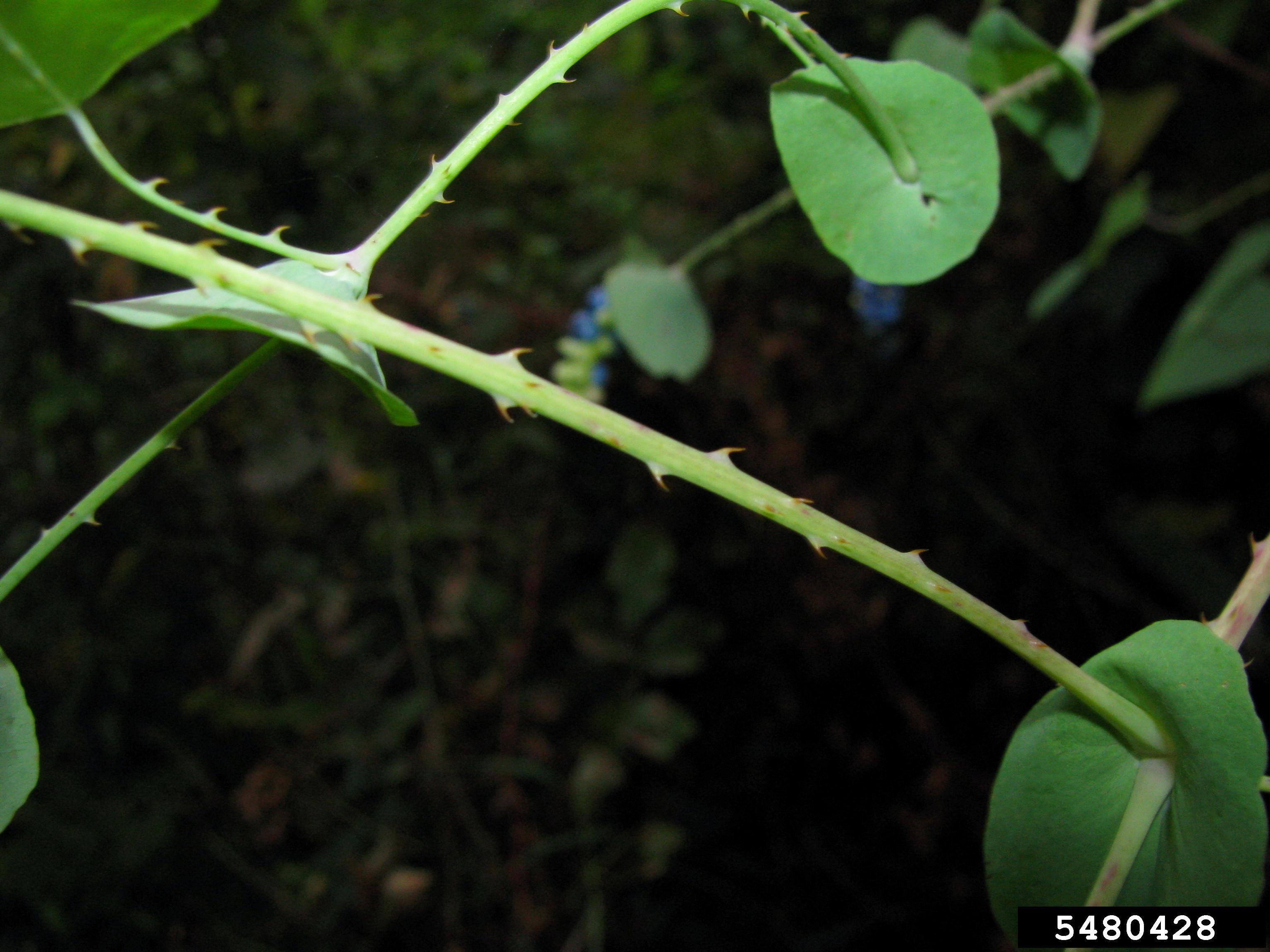
(Figure 3) The delicately narrow, green to red-tinted stems, and the petiole (leaf stem) and midrib on the underside of the leaves are armed with small, stiff, recurved barbs. Image by: Leslie J. Mehrhoff, University of Connecticut, Bugwood.org
Resources:
Mile-a-Minute Vine, FNR-481-W, The Education Store, Purdue Extension’s resource center
Mile-a-minute vine: What you need to know about the plant that can grow 6 inches a day, Indianapolis Star
Invasive Species – Indiana Department of Natural Resources (IDNR)
Ask an Expert – Purdue Extension-Forestry and Natural Resources
Indiana Invasive Species Council – Includes: IDNR, Purdue Department of Entomology and Professional Partners
EDDMaps – Early Detection and Distribution Mapping System
Report Invasives, College of Agriculture
Great Lakes Early Detection Network App (GLEDN) – The Center for Invasive Species & Ecosystem Health
Ron Rathfon, Regional Extension Forester SIPAC
Purdue Department of Forestry and Natural Resources
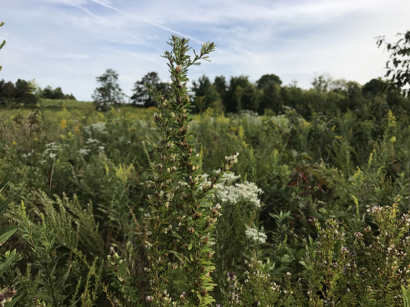 Sericea lespedeza is arguably one of the most problematic invasive species of old fields, prairies and other early successional areas managed for wildlife. Sericea lespedeza is a perennial legume native to eastern Asia that was originally promoted for erosion control, cattle forage, cover and food for wildlife. But as with many plant introductions during the early and mid-19th century (e.g., multiflora rose, autumn olive, and bush honeysuckle), the original beliefs – while well intentioned – were ill fated and short-sided. Sericea has become invasive, is considered noxious in many states, and can be found from Massachusetts to Nebraska and from Florida to Ontario.
Here are 3 problems with sericea and 3 tools for control.
Problems:
- Sericea is adapted to a wide variety of conditions: sericea is able to tolerant and thrive in acidic soils with relatively low soil fertility and is also drought tolerant. These factors combined with allopathic chemicals makes sericea extremely competitive causing sericea to quickly invade and overtake early successional areas displacing many native species.
- Sericea produces an abundance of seed: one sericea plant is able to produce more than 1000 seeds and seeds are thought to be viable for up to 20 years in the seedbank. Sericea was initially thought to provide an abundance of seed valuable to wildlife including northern bobwhite. However, the seed cannot be digested by most wildlife, thus it provides no nutritional benefits and bobwhite can actually starve by consuming only sericea seed. Research in Kansas also reported a higher percentage of sericea seed germinated after passing through the digestive system of bobwhite compared to unconsumed seed.
- Sericea responds prolifically following spring fires: fire is the most effective way to manage early successional vegetation. However, fire during the dormant season seems to only anger sericea and exacerbate the problem. Fire scarifies sericea seed and seedling density is increased following spring fires.
Control: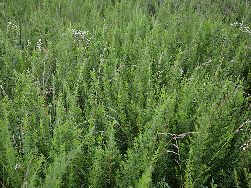
- Herbicide: triclopyr (32 oz/acre), triclopyr + fluroxypyr (1.5 pt/acre), or glyphosate (1-2 qt/acre) can be used to effectively control sericea in early successional areas from June through July when sericea is 12-18 inches tall. Metsulfuron methyl (1 oz/ac) provides effective control when applied to sericea during flowering (Aug-Sep).
- Prescribed fire: while prescribed fire during the dormant season enhances sericea germination, fire during the late-growing season (July-Sep) can reduce sericea seed production and can decrease sericea survival. However, fire alone may not be enough to control sericea long term.
- Herbicide + Prescribed Fire: sericea can be controlled with herbicide during the growing season. This can be followed up with a late-growing season fire to consume any sericea not killed by the herbicide and reduce sericea seed production. The following summer herbicide can be used again to kill any new sericea seedlings or plants that have resprouted from rhizomes.
If you find sericea in fields that you manage, working quickly to stop seed production and kill the existing plants will be the most effective way to control an invasion.
Web Resources:
Herbicides to control sericea lespedeza, Southeastern Association of Fish & Wildlife Agencies
Effects of Growing-Season Prescribed Burning on Vigor of Sericea Lespedeza in the Kansas Flint Hills: I. Suppression of Seed Production and Canopy Dominance, Kansas Agricultural Experiment Station Research Reports
Other Resources:
If Your Native Grasses Look Like This, It’s Time for Management, Got Nature?, Purdue Extension-FNR
Invasive plants: impact on environment and people, The Education Store, Purdue Extension
Jarred Brooke, Extension Wildlife Specialist
Purdue University Department of Forestry and Natural Resources
 Check out the new publication entitled Invasive Plants: Impact on Environment and People now available in The Education Store!
Invasive species are plants, animals, or pathogens that are nonnative (or alien) to the ecosystem under consideration and whose introduction causes or is likely to cause harm. An invasive species is a nonnative species that can cause significant environmental and economic losses. Invasive species are said to be the second leading cause of biodiversity loss, after habitat loss.
This lesson teaches students about the significant environmental and economic losses that can be caused by the introduction of invasive plant species. It includes a game that can be played in class, plus a worksheet. The lesson meets multiple Indiana science, natural resources, math, and social studies standards.
Resources:
The Nature of Teaching – Purdue Extension
Alternative Options for Invasive Landscape Plants, The Education Store
Invasive Plant Species in Hardwood Tree Plantations, The Education Store
Invasive Plant Species: Callery Pear, Youtube, Education Store
Invasive Plants of the Eastern US, The Education Store
Mysha Clarke, Graduate Research Assistant,
Purdue University Department of Forestry and Natural Resources
Zhao Ma, Associate Professor of Sustainable Natural Resources Social Sciences
Purdue Department of Forestry and Natural Resources
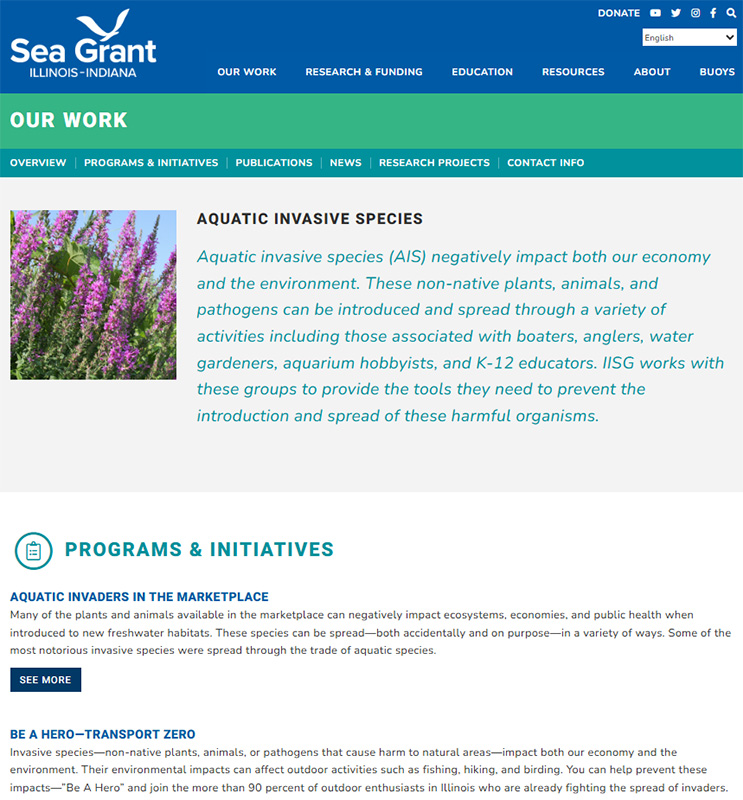
Once aquatic invasive species (AIS) are established in a new environment, typically, they are difficult or impossible to remove. Even if they are removed, their impacts are often irreversible. It is much more environmentally and economically sound to prevent the introduction of new AIS through thoughtful purchasing and proper care of organisms. Check out Illinois-Indiana Sea Grant’s web page the Aquatic Invasive Species and find resources for teachers, water garden hobbyists, aquatic landscaping designers and to aquatic enthusiasts. The video titled Beauty Contained: Preventing Invasive Species from Escaping Water Gardens is also available which contains guidelines that were adopted from the Pet Industry Joint Advisory Council and the Aquatic Nuisance Species Task Force along with addressing the care and selection of plants and animals for water gardens.
Resources:
Aquatic Invaders in the Marketplace, Illinois-Indiana Sea Grant (IISG)
Great Lakes Sea Grant Network (GLERL), NOAA – Great Lakes Environmental Research Laboratory
Indiana Bans 28 Invasive Aquatic Plants, Illinois-Indiana Sea Grant (IISG), Newsroom
A Field Guide to Fish Invaders of the Great Lake Regions, Illinois-Indiana Sea Grant (IISG)
Purdue Researchers Get to the Bottom of Another Quagga Mussel Impact, Illinois-Indiana Sea Grant (IISG)
Protect Your Waters, U.S. Fish and Wildlife Service & U.S. Coast Guard
Clean Boat Programs, Illinois-Indiana Sea Grant
Illinois-Indiana Sea Grant (IISG)
University of Illinois Extension and Purdue University Extension
Many of the invasive plant issues we experience in the urban ecosystem is due to improper plant selection when landscaping our homes and businesses. Often times, nurseries and garden centers stock trees and shrubs that create major issues in nearby natural areas. Landscapers everywhere seek beautiful, unusual, exceptionally hardy, drought-tolerant, or fast-growing plants. Unfortunately, plants selected for their resilience may be invasive because of their adaptable nature. Plants selected for their aesthetic value may be hard to banish from garden centers even after their invasive tendencies are revealed. These plants are typically prolific seed-producers which birds deposit everywhere creating competition for native plants.
Invasive species are damaging because they:
- produce large numbers of new plants each season.
- tolerate many soil types and weather conditions.
- spread easily and efficiently, usually by wind, water, or animals.
- grow rapidly, allowing them to displace slower growing plants.
- spread rampantly when they are free of the natural checks and balances found in their native range.
One of the worst offenders for invasive qualities is the Callery Pear. This ornamental pear, famous for its prolific white flowers in spring, creates a beautiful display in many landscapes. However, it is a poor choice for two major reasons. It is highly invasive and can take over entire natural areas with its heavy seed production. In addition, it is a very weak-wooded tree with poor branch structure, leaving it susceptible to splitting and breaking under heavy winds. Check out this publication for more information on the Callery Pear. See Invasive Plant Species: Callery Pear video for more information.
To help prevent the spread of invasive species, choose plants wisely. Use the following publication as a guide for alternatives for invasive landscape plants, Commercial Greenhouse and Nursery Production: Alternative Options for Invasive Landscape Plants.
Resources:
Invasive Plant Species: Callery Pear – The Education Store, Purdue Extension Resource Center
Invasive Plant Species: Oriental Bittersweet – The Education Store
Invasive Plant Species: Wintercreeper – The Education Store
Invasive Plant Species Fact Sheets: Poison Hemlock – The Education Store
Mile-a-minute Vine – The Education Store
Commercial Greenhouse and Nursery Production: Alternative Options for Invasive Landscape Plants, The Education Store
Invasive Species – Purdue Extension
Indiana’s “Most Unwanted” Invasive Plant Pest List – Indiana Cooperative Agricultural Pest Survey (CAPS) Program
Indiana Invasive Species Council – Includes: IDNR, Purdue Department of Entomology and Professional Partners
Invasive Species – Indiana Department of Natural Resources (IDNR)
National Invasive Species Awareness Week: February 27-March 3, 2017
Lindsey Purcell, Urban Forestry Specialist
Purdue University, Department of Forestry and Natural Resources

Issue:
Woodlands provide a multitude of environmental (e.g., carbon sequestration, enhance water quality, wildlife habitat), economic (e.g., timber, wood products manufacturing, tourism), and social (e.g., recreation, aesthetics) benefits to Indiana residents. The sustainability of these benefits is strongly tied to stability of the resource. In Indiana, 75 percent of the 4.65 million acres of forestland is owned by families. Actions they take on their property can impact the benefits woodlands provide all Indiana residents. However, many do not understand available options or sources of assistance.
What Has Been Done:
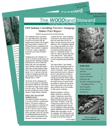 The Department of Forestry and Natural Resources, in partnership with many other organizations, helps produce and mail over 31,000 copies of the Indiana Woodland Steward to woodland owners three times each year. This 16-page, two-color publication includes in-depth articles on forest stewardship and health, invasive species and pests, wildlife habitat management, economics, and more.
Results:
Subscribers owned more woods (71.6 ac) for a longer tenure (33 years) than the average woodland owner in Indiana based on data from the National Woodland Owner Survey. As a group, they were also more active managers based on the proportion enrolled in assistance programs and who had a written stewardship plan. Fifty-four percent regularly utilized information from the Woodland Steward. In addition, 51 percent of respondents have implemented at least one practice they read about from The Woodland Steward, potentially impacting an estimated 1.2 million acres of forestland. His use of print media to communicate with woodland owners could be considered expensive, but clearly a large number of woodland owners regularly read and utilize the information making the average investment per landowner much lower.
Recent Posts
- Connecting Research to Practice: Natural Resources & Land Use Spring Training
Posted: June 5, 2026 in Forestry, Forests and Street Trees, How To, Invasive Animal Species, Invasive Plant Species, Land Use, Natural Resource Planning, Urban Forestry, Wildlife, Woodlands - Invasive Species in Eastern Forests, Webinar Series
Posted: April 20, 2026 in Invasive Insects, Invasive Plant Species, Urban Forestry, Wildlife - As the spring wildflowers emerge, so do the woodland invaders
Posted: April 16, 2026 in Forestry, Forests and Street Trees, Invasive Plant Species - Replace Invasives with Natives: 2026 Plant Swap Program
Posted: April 13, 2026 in Invasive Plant Species, Urban Forestry - Control Management of Poison Hemlock
Posted: February 24, 2026 in Ask the Expert, Forestry, How To, Invasive Plant Species - Purdue Extension: Empowering Indiana Through Innovation, Education and Community Impact
Posted: January 28, 2026 in Community Development, How To, Invasive Insects, Invasive Plant Species, Natural Resource Planning, Woodlands - Learn How to Control Reed Canarygrass
Posted: December 8, 2025 in Forestry, Invasive Plant Species, Wildlife - Controlling Introduced Cool-Season Grasses
Posted: December 1, 2025 in Forestry, Invasive Plant Species, Wildlife - Managing Common and Cut Leaved Teasel
Posted: November 24, 2025 in Forestry, Invasive Plant Species, Wildlife - Crownvetch, Sweetclover and Birdsfoot Trefoil Control
Posted: November 17, 2025 in Forestry, Invasive Plant Species, Wildlife
Archives
Categories
- Alert
- Aquaculture/Fish
- Aquatic/Aquaculture Resources
- Ask the Expert
- Christmas Trees
- Community Development
- Disease
- Drought
- Forestry
- Forests and Street Trees
- Gardening
- Got Nature for Kids
- Great Lakes
- How To
- Invasive Animal Species
- Invasive Insects
- Invasive Plant Species
- Land Use
- Natural Resource Planning
- Nature of Teaching
- Plants
- Podcasts
- Ponds
- Publication
- Safety
- Spiders
- Timber Marketing
- Urban Forestry
- Webinar
- Wildlife
- Wood Products/Manufacturing
- Woodland Management Moment
- Woodlands