Welcome to
Administrative Operations
We are committed to safely and reliably serving our campus customers while supporting both the university’s day-to-day operations and the strategic vision for the future.


Service Worker Appreciation

We Power Purdue
Every day, hundreds of dedicated service workers help keep Purdue running. From maintaining our learning environments to preparing campus for major events like commencement, their work powers the experiences that make this university thrive.
SEE Our Impact
Purdue University and Small Modular Nuclear Reactors
Home to one of the nation’s top nuclear engineering programs and a national leader in energy innovation that is scalable and sustainable, Purdue and its experts are uniquely qualified to study small modular and advanced reactor technology.
Learn more about our work with Duke Energy and the Indiana Office of Energy Development:

Our work on campus


Operations & Maintenance
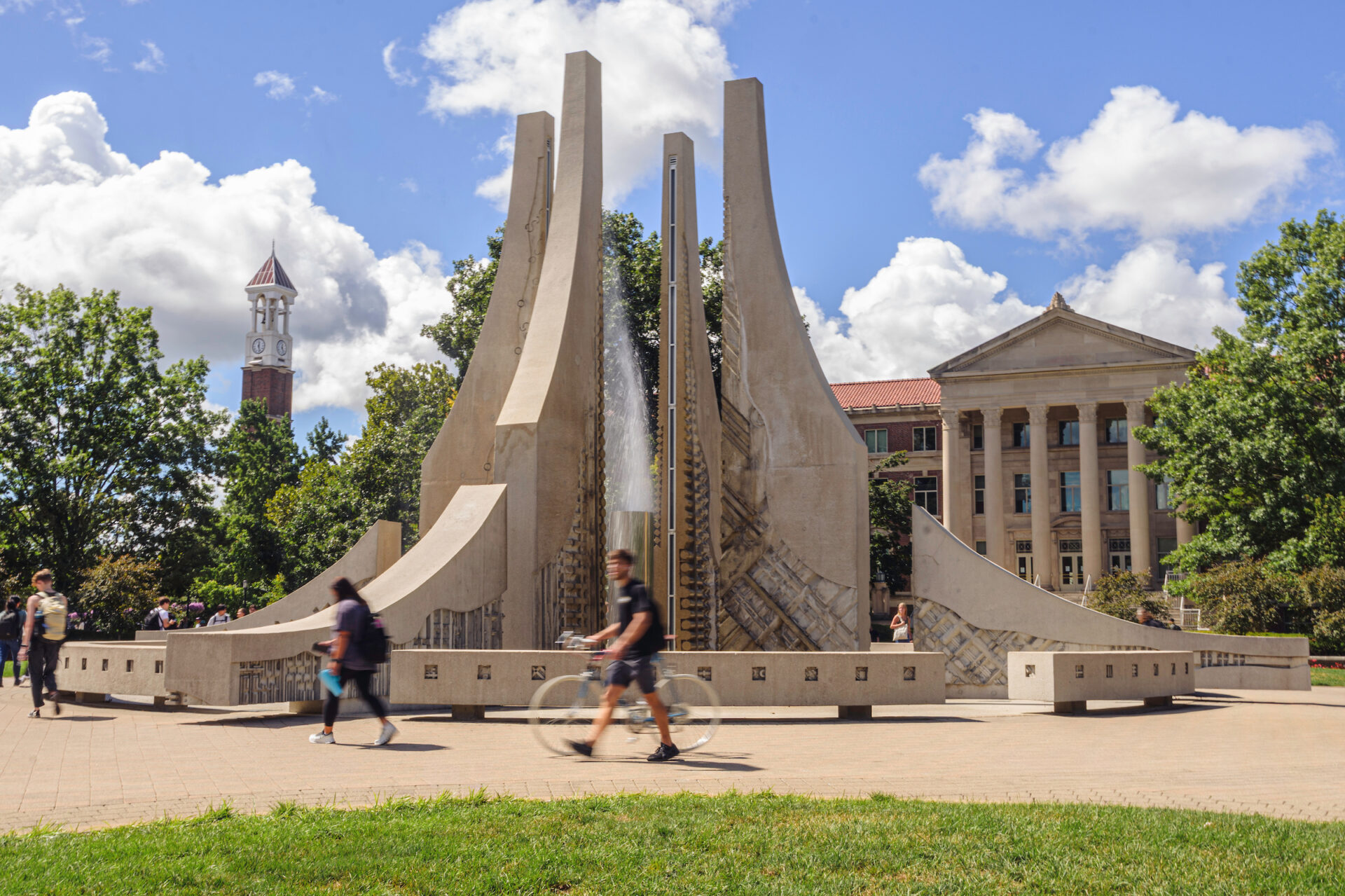
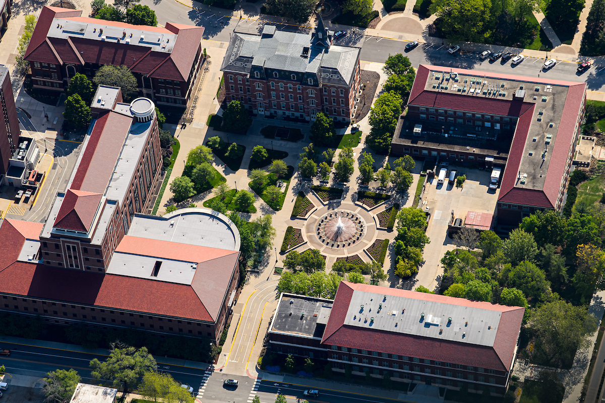
Class of 1939 Water Sculpture
Our Operations and Maintenance department is responsible for maintaining the iconic fountains on the West Lafayette campus.
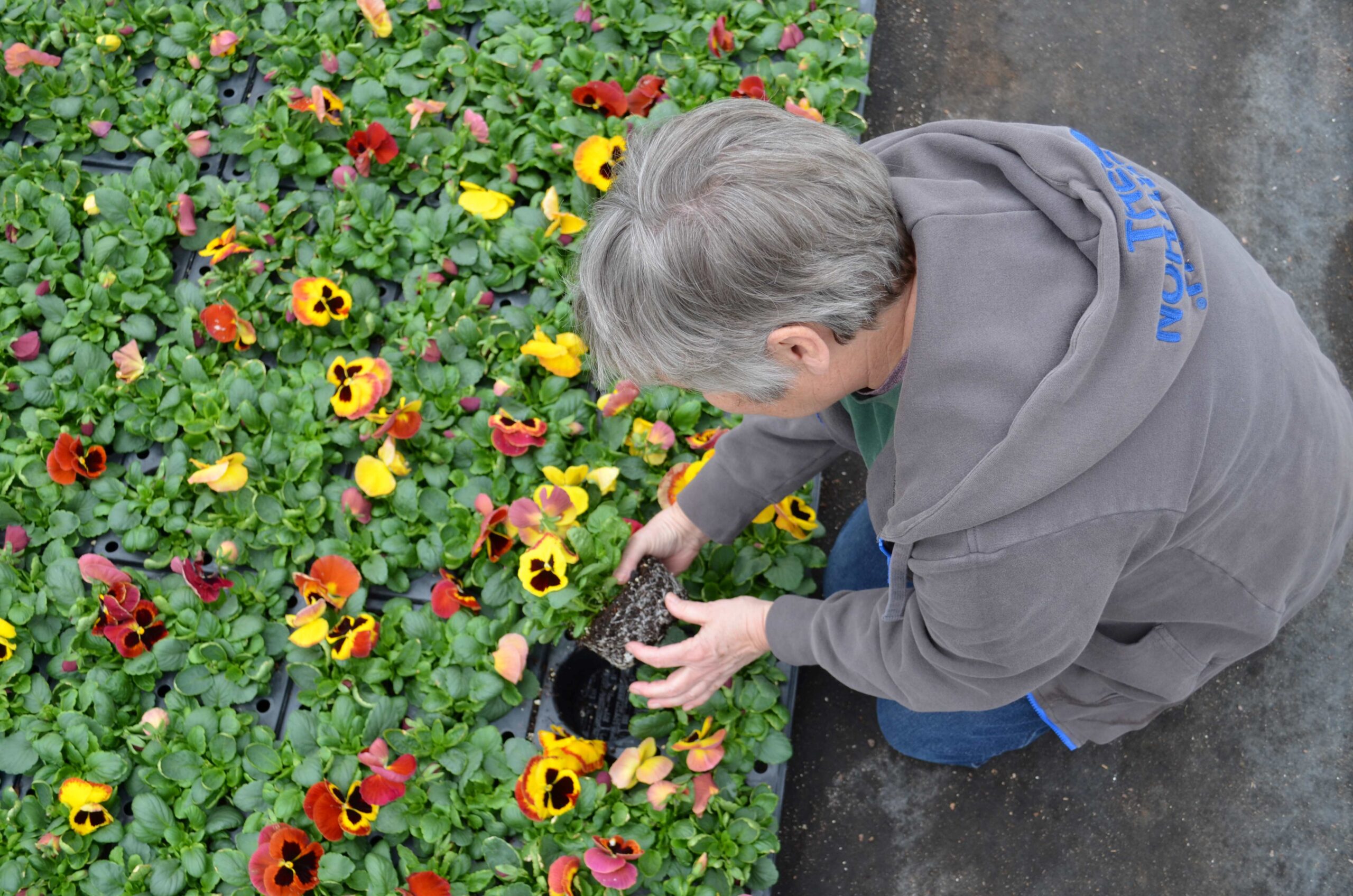
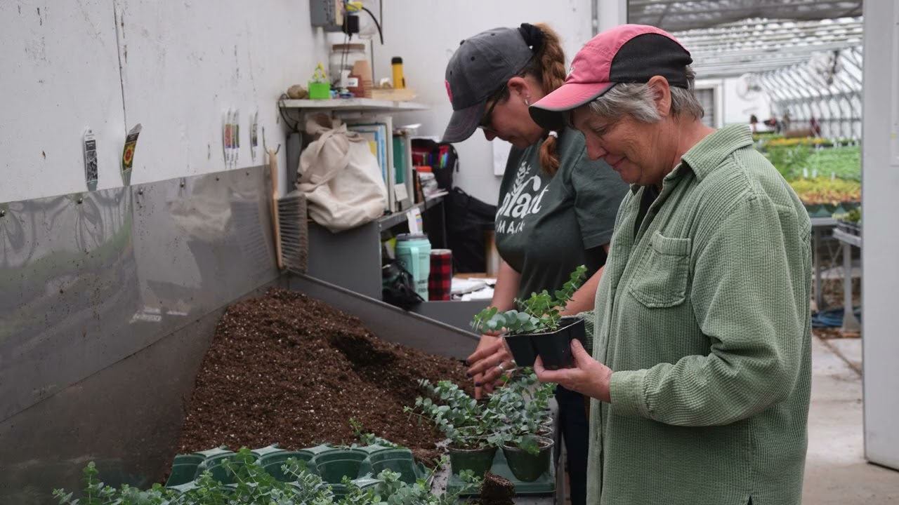
Grounds
Landscaping
Campus flowers are propagated and grown in the department’s greenhouses. Flowers are then planted and maintained in flower beds, pots and hanging baskets around campus.
Auxiliary Services
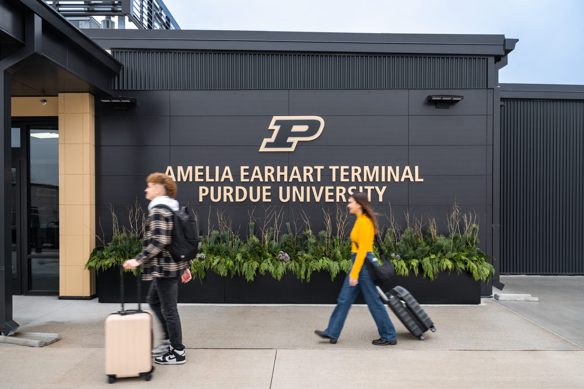
Amelia Earhart Terminal
The Amelia Earhart Terminal at Purdue University Airport (LAF) officially opened in 2025. The airport currently offers United Express flights operated by SkyWest to Chicago O’Hare International Airport.
Auxiliary Services
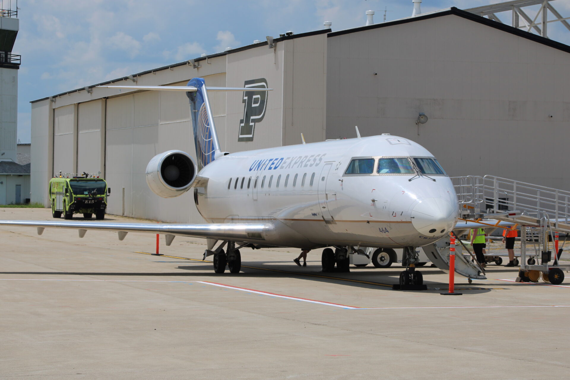
Purdue Airport
Now offering commercial air service, the Purdue Airport provides many opportunities for our campus.

Public Safety
ETS Boxes
Nearly 300 Emergency Telephone System (ETS) boxes are located at almost every street intersection and other strategic locations on campus. The ETS boxes are yellow or black, have a blue light on top and are marked “EMERGENCY” or “911.”

Grounds
Tree Planting
The arborists remove and plant trees as part of the carefully developed Campus Tree Care Plan, a continuous improvement effort that guides the assessment, care and management of campus trees.

Auxiliary Services
Retail Dining
Purdue Memorial Union’s Atlas Family Marketplace has a wide variety of dining options to satisfy you. From Starbucks® to sushi, we have you covered.

Auxiliary Services
The Spa Union Club Hotel
The Spa is a boutique wellness retreat nestled in the Union Club Hotel at Purdue University.
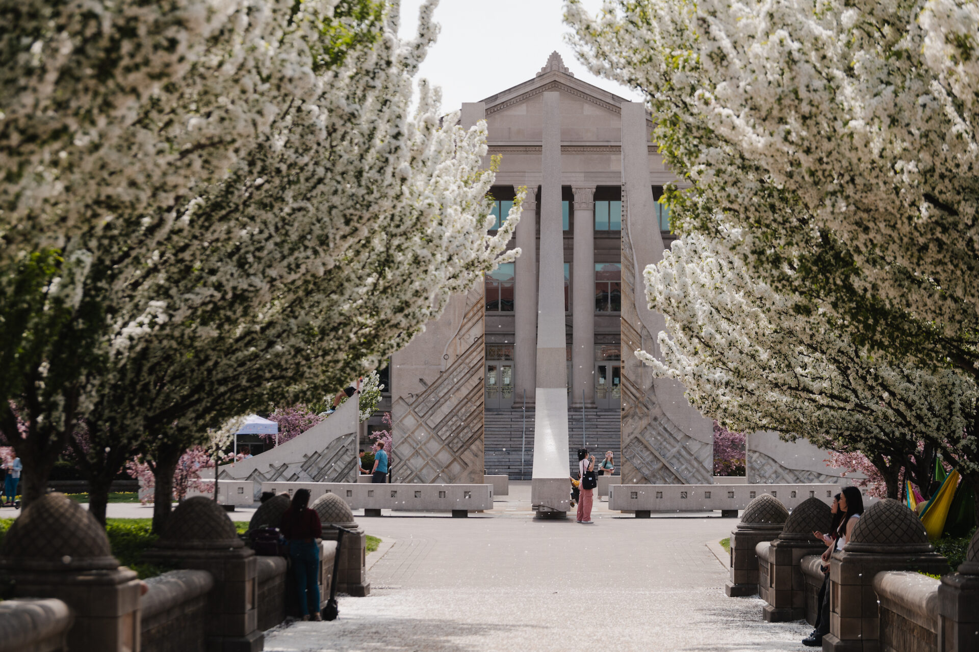
Operations & Maintenance
Class of 1939 Water Sculpture
Our Operations and Maintenance department is responsible for maintaining the iconic fountains on the West Lafayette campus.
Grounds
Landscaping
Campus flowers are propagated and grown in the department’s greenhouses. Flowers are then planted and maintained in flower beds, pots and hanging baskets around campus.
Auxiliary Services
Amelia Earhart Terminal
The Amelia Earhart Terminal at Purdue University Airport (LAF) officially opened in 2025. The airport currently offers United Express flights operated by SkyWest to Chicago O’Hare International Airport.
Auxiliary Services
Purdue Airport
Now offering commercial air service, the Purdue Airport provides many opportunities for our campus.
Public Safety
ETS Boxes
Nearly 300 Emergency Telephone System (ETS) boxes are located at almost every street intersection and other strategic locations on campus. The ETS boxes are yellow or black, have a blue light on top and are marked “EMERGENCY” or “911.”
Grounds
Tree Planting
The arborists remove and plant trees as part of the carefully developed Campus Tree Care Plan, a continuous improvement effort that guides the assessment, care and management of campus trees.
Auxiliary Services
Retail Dining
Purdue Memorial Union’s Atlas Family Marketplace has a wide variety of dining options to satisfy you. From Starbucks® to sushi, we have you covered.
Auxiliary Services
The Spa Union Club Hotel
The Spa is a boutique wellness retreat nestled in the Union Club Hotel at Purdue University.