Purdue part of field study to improve severe weather forecasting
May 16, 2013
 |
|
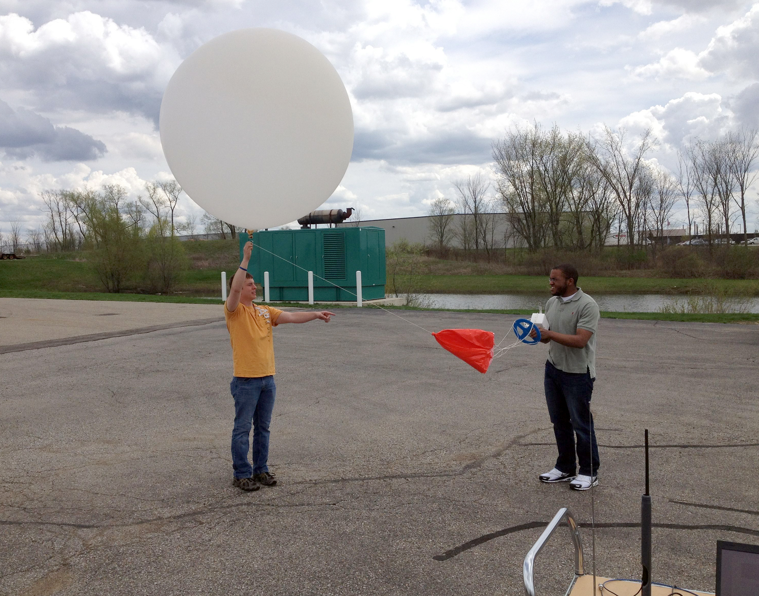
Purdue graduate students, from left, Joe Woznicki and Logan Dawson work with a weather balloon. Woznicki and Dawson are part of a Purdue team, led by professors Jeff Trapp and Michael Baldwin, participating in the Mesoscale Predictability Experiment to improve severe storm prediction. (Purdue University photo/Jeff Trapp) |
WEST LAFAYETTE, Ind. — Purdue University professors and students will intercept storms as part of a major field project to improve predictions of severe weather and offer earlier warnings to those in its path.
Purdue professors of earth, atmospheric and planetary sciences Jeff Trapp and Michael Baldwin, and graduate students Joe Woznicki and Logan Dawson are part of the National Science Foundation-funded Mesoscale Predictability Experiment, or MPEX. The project runs from May 15 to June 15 across the Great Plains.
Currently, same-day forecasts note the likelihood of severe storms, but are uncertain where and when the storms will develop. The MPEX study will help determine whether additional detailed observations can lead to more specific forecasts of storm location and behavior as much as a day in advance.
The Purdue team is leading a portion of the project that will release weather balloons around active thunderstorms. The balloons will carry small instrument packages called radiosondes to continuously measure temperature, humidity, pressure and winds as the balloon rises. This information will be combined with earlier atmospheric measurements using similar instrument packages dropped from an aircraft at high altitudes.
These measurements will reveal how much the storms have changed or disturbed the surrounding atmosphere, said Trapp, who is one of four lead investigators for the MPEX project.
"The project has its roots in chaos theory and the related idea about how the 'flapping of a butterfly's wings could cause the formation of a tornado in Texas,' " he said. "We are trying to see if thunderstorms create an identifiable ripple effect, and, if they do, how we can use that information to better predict the weather."
The team is particularly interested in "supercell" thunderstorms, the intense and long-lasting storms most likely to produce tornadoes. These thunderstorms have strong vertical air currents that move warm air up and cool air down, as well as strong rotations that mix the atmosphere horizontally.
"We know that even isolated, short-lived thunderstorms influence their environment," he said. "Through this field study we will quantify the magnitude and extent of these warming and mixing effects on the atmosphere."
A project goal is to help improve forecasts in the 6- to 24-hour period. Currently severe weather warnings from the National Weather Service provide up to an hour's notice of tornadoes and other threats on a county-by-county basis. Tornado and severe thunderstorm watches are issued up to eight hours in advance and cover state-sized areas; while convective outlooks highlight the risk of severe weather up to eight days in advance across large parts of the country.
In addition to Purdue University, institutions involved in the project include the National Center for Atmospheric Research (NCAR); Colorado State University; the University at Albany, State University of New York; the University of Wisconsin–Milwaukee; and NOAA's National Severe Storms Laboratory (NSSL).
Advanced forecast models can now simulate the weather at points packed as closely as about a half-mile from each other, which allows showers and thunderstorms to be explicitly depicted. However, these experimental models and those used for operational weather prediction still struggle at times to map out storm behavior, especially beyond about six hours in advance.
Scientists believe this may largely be because the models need more detail on upper-level features, such as pockets of strong wind or dry air, located several miles above ground level. As these features move into the Plains, they can be critical for triggering or suppressing severe storms. Weather satellites may not see these features, and they often go undetected by limited surface and upper-air networks across the Rocky Mountain states.
"The structure of the atmosphere two to six miles above sea level is incredibly important," said NCAR scientist Morris Weisman, another of the project's four principal investigators. "This appears to be where the biggest forecast errors develop, so we need to collect more data at these heights."
MPEX includes flights of the specially instrumented NSF/NCAR Gulfstream V aircraft, also known as the High-performance Instrumented Airborne Platform for Environmental Research. The aircraft will cruise at 40,000 feet for up to six hours to sample the prestorm atmosphere and canvass for triggers of severe weather across Colorado and nearby states.
On each day of operations, MPEX will produce an ensemble of up to 30 forecasts using the NCAR-based research version of the multiagency Weather Research and Forecasting model, WRF-ARW. The MPEX team will also evaluate how much the data from research flights improves forecasts in two other modeling systems, both of which are updated each hour.
Media contact: Elizabeth K. Gardner, 765-494-2081, ekgardner@purdue.edu
Media contact for UCAR: David Hosansky, 303-497-8611, hosansky@ucar.edu
Source: Jeff Trapp, jtrapp@purdue.edu
Related release:
NCAR/UCAR release
Related website:
UCAR
