
Arctic River Hydrology
The Arctic is warming faster than anywhere on Earth, reshaping its rivers and watersheds. We use isotope tracers and machine learning to study water and weathering across northern river basins — mapping tap-water and surface-water isotopes across Canada, tracing lithium and strontium isotope variability across the Yukon River basin, and developing scalable permafrost mapping. This research links isotope geochemistry to water-resource sustainability, contaminant cycling, weathering, and carbon cycling in a rapidly changing subarctic landscape.
Model and Spatial Distribution
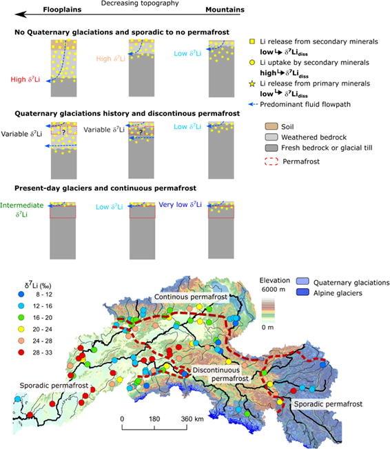
Conceptual model and spatial distribution of lithium isotope (δ⁷Li) variability across permafrost and glaciation regimes.
Top panels illustrate how fluid pathways, mineral weathering, and lithium exchange differ along a topographic gradient from floodplains to mountains under three scenarios:
(1) no Quaternary glaciation with minimal permafrost
(2) past glaciations with discontinuous permafrost
(3) present-day glaciers with continuous permafrost
These conditions control Li release and uptake by primary and secondary minerals, generating distinct δ⁷Li signatures. The bottom panel maps δ⁷Li values across a mountainous region, highlighting spatial patterns associated with continuous, discontinuous, and sporadic permafrost zones and glaciated terrains.