
Isoscapes and Data Science
This is the methodological foundation of everything we do. Isoscapes are predictive maps of how isotope ratios vary across the landscape. We build them by combining field sampling with machine-learning models, spatial statistics, and large open databases. Our group pioneered the move from single-isotope to multi-isotope geolocation—demonstrating far greater discriminating power—and contributes to community infrastructure such as IsoBank and global strontium isoscape compilations to make isotope science reproducible, open, and broadly usable. These tools underpin every applied theme below.
Detailed diagram
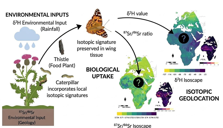
A detailed scientific diagram demonstrating multiple isotope geolocation for a Painted Lady butterfly (Vanessa cardui). The process shows how hydrogen and strontium isotopes are incorporated from the larval environment into adult tissues and compared to known geographical isoscape maps to determine its origin across its migratory circuit.
isotope database
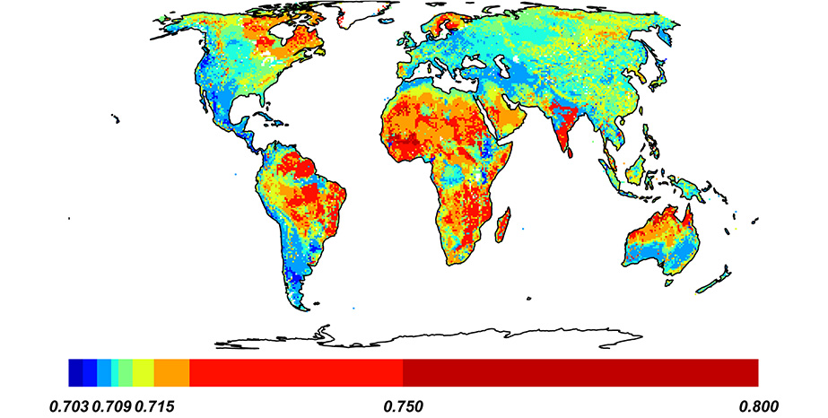
Global map of predicted bioavailable 87Sr/86Sr from random forest regression. This isoscape can be updated or generated for other regions using the R script found within this research article Research Compendium for ‘Distant Provenance of Archaeological Dogs in Chiapas Confirms Complex Trade Networks within Mayan Societies’ and the ARDUOUS global strontium isotope database found within this research Global Compilation of Bioavailable Strontium Isotope Data.