
Purdue Profiles: Dev Niyogi
Dev Niyogi, Indiana state climatologist and associate professor of agronomy and earth and atmospheric sciences. (Purdue University Photo/Mark Simons)
A common phrase in Indiana is, if you don't like the weather, wait a couple of minutes. As Indiana's state climatologist, Dev Niyogi sort of laughs off this expression.
"You know, I was watching the news just the other day and heard the exact same thing about Georgia," says Niyogi, associate professor of agronomy and earth and atmospheric sciences. "Weather, climate in general, can be fascinating and often unpredictable."
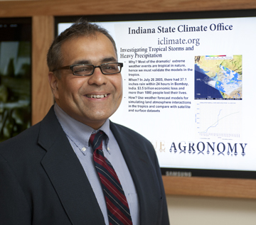
Though Lafayette residents buried under inches of snow may contest Georgia's difficulty, there is little doubt that tracking patterns in Indiana's weather is a harrowing task. In his capacity as Indiana state climatologist, Niyogi coordinates the Indiana State Climate Office. The office, which was established at Purdue in 1956, acts as the state's official source for climate data.
How did you become interested in climatology?
There was nothing strategic about my interest, really. As a child I developed a fascination with the smoke coming from chimney stacks. One thing that always intrigued me was trying to predict its pattern, whether it would be to fanning out, looping or mixing up.
Later, it intrigued me that, when we think about it, something so complex as weather can be explained by so few equations. There are about 10 equations that plug in together to provide a forecast in which billions of dollars worth of decisions are made. Of course, this handful of equations has several modifications, but at the core you just have that. It has always fascinated me to describe and analyze nature in a mathematical way.
What does a climatologist do?
I like to think that a climatologist finds simplicity within the complexity of the natural systems. A climatologist looks at evolving climatic patterns. From these, we infer how different phenomena, such as clouds, oceans, wind, and thunderstorms all interlink. Essentially, today's weather becomes tomorrow's climate. We study the climate of a region and use that data for very applied aspects such as agriculture or utility demands. As is often said, a meteorologist will tell you whether to take an umbrella to work. A climatologist will tell you when to buy your winter clothes or if you even need to buy an umbrella.
What do you do in your role as Indiana state climatologist?
One function of the Indiana State Climate Office is to aggregate and analyze climatic data. Since weather and climate know no boundaries, there are a number of National Weather Service offices that have zones within Indiana. Our office works with these offices to provide a climatic picture of the state.
We also work with regional and national centers. Though the occurrences at national and global scales make news, people need information ranging from their backyard to across the continent if you are someone watching the agricultural market in a different country.
A large part of what we do is converting the global data to locally and regionally relevant information. We do this by answering queries from residents, companies and policymakers to assist with day-to-day decisions. One example is an inquiry about whether the upcoming growing season will be similar to the previous year. Perhaps, whether they will encounter the wet fields again this year or will conditions be more normal? Another example would be an insurance company investigating a fender-bender on I-65. The driver said it was foggy and couldn't see more than 10 feet ahead. Our office can help by providing information and examining climatic data sets to determine if the weather conditions coincided with a dense fog. Queries can range from simple questions, such as a student researching a homework assignment to complex issues such as a company wanting to understand how changing weather and climatic patterns impacts its energy consumption. Essentially, we are here to help individuals, communities, and businesses in terms of analysis for the data we aggregate.
Does Indiana pose any distinctive issues in regards to climatology?
I often say that Indiana is topographically challenged. Though we don't have the complex topographical weather patterns that occur with the Appalachian Mountains, such as cold air damming and so forth, we do have interesting weather challenges. We have zones that are almost perfectly designed for agriculture with the right amount of rainfall and sunshine and others that are heavily impacted by lake effect. Very high impact weather patterns emerge at these boundaries.
Indiana is often at the boundary where either a warm air mass coming from the south or cold air mass from the north impacts us. This makes analyzing weather and climatic variability difficult because, depending on which dominates, a weather system can either hit or miss us. This is especially challenging in wintertime scenarios because of the considerable rain-to-snow ratio. The amount of moisture used to produce one inch of rain can potentially yield 10 inches of snow and the solid or liquid form of precipitation depends on which air mass dominates. At the same time, we also have pockets of areas which have highly localized temperature and rainfall patterns. These micro and regional-scale issues all make climate and weather patterns over Indiana quite distinctive.
In addition to your position as Indiana's state climatologist, you also conduct your own research. What does your research focus on?
My research focuses on understanding the role of land surface heterogeneity or land use change, such as urbanization, deforestation and agricultural intensification, which affect regional or global weather patterns.
So, for regional applications, let's take this example. If you look at Indiana thunderstorms in the past 10 years, you see fascinating patterns. One pattern is that storms start to diverge as they approach Indianapolis. After they pass through the city, they re-emerge and become stronger downwind of that urban area. One of my focuses is determining how the presence of a city could possibly affect a storm that is thousands of feet above the surface.
A larger-scale application of my research would be looking at the role land use change is playing in altering the regional hydrology and climate. For example, there is a phenomenon called the urban heat island wherein urban areas show significantly warmer temperatures than surrounding rural areas. It is significant to understand if we can help devise policies and actions to address land use management as a solution to buffer against global changes.