
Purdue researchers returning to Haiti to examine possibility of another major earthquake
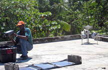
Louis Obenson of the Civil Protection Agency of Haiti installs GPS equipment in Port-au-Prince. (Purdue University/Eric Calais)
WEST LAFAYETTE, Ind. - A team led by Purdue University experts is returning to Haiti this week to investigate the cause of the Jan. 12 magnitude 7 earthquake and collect crucial data to assess whether it could trigger another major event to the east or west of Port-au-Prince.
Eric Calais, a professor of geophysics at Purdue who leads the National Science Foundation-funded team, said most aftershocks occur within weeks of the initial quake and the team urgently needs to get to the site to make a detailed assessment before critical geological information disappears.
"The big question is, instead of small aftershocks, could there be a bigger earthquake coming? There are many historical examples of an initial earthquake triggering an even larger one along the same or nearby faults," Calais said. "We are concerned for the Dominican Republic, as our preliminary models show that the continuation of the fault in this area is loaded."
The Jan. 12 quake killed an estimated 200,000 people in Haiti, left 250,000 injured and made 1.5 million homeless, according to Associated Press reports. Port-au-Prince experienced a magnitude 6 aftershock on Jan. 20.
The Haitian Bureau of Mines and Energy and the Civil Protection Agency invited Calais and his team back to the country to examine the fault and advise officials as they prepare to rebuild, he said.
"The government needs scientifically-informed advice to decide what to do now and in the future when they start thinking about rebuilding," Calais said. "We know how to do the calculations that will tell us if the likelihood of other earthquakes along the fault has increased, but we need information that we can only get by going to the field, making direct observations and taking measurements on the ground."

This map shows changes in Coulomb failure stress caused by the magnitude 7 earthquake on Jan. 12. Areas shown in red have been brought closer to rupture and grey circles indicate the location of aftershocks. (Purdue University/Eric Calais)
Calais' research team has been measuring the build up of energy along the Enriquillo and Septentrional faults on the island of Hispaniola, which includes Haiti and the Dominican Republic, using global positioning system (GPS) technology. The team has studied the area for five years using 100 GPS markers and in 2008 reported the potential for a magnitude 7.2 earthquake in Haiti and a magnitude 7.5 earthquake in the
The NSF awarded the team a $130,000 Rapid Response Grant to find and map the area of the fault that ruptured, resurvey existing GPS markers, and install 10 new continuous GPS sites to monitor changes that will occur in the years to come as the Earth's crust readjusts.
Tim Killeen, NSF assistant director for geosciences said, "The GPS and geological data gathered by this team should provide important insights into the cause of the Jan. 12, 2010, Haitian earthquake and are essential for evaluating the potential for future earthquakes in the Port au Prince area."
The research team includes Purdue professor of earth and atmospheric sciences Andrew Freed and graduate student Sarah Stamps; Paul Mann of the University of Texas at Austin; Glenn Mattioli of the University of Arkansas; Estelle Chaussard of the University of Miami; and Richard Koehler of the Alaska Division of Geological and Geophysical Surveys.
Mann, who worked in Haiti in the past and has extensive experience in the geology of the region, will lead the search for the fault responsible for the quake. The team will collaborate with the U.S. Geological Survey.
Technical support for the operation is provided by UNAVCO, the NSF-supported facility for geodesy in Boulder, Colo.
From GPS measurements at the surface, the team can determine what happened along the fault through its full depth 20 kilometers underground. Precise measurements of this underground movement are critical for validating models of stress changes that can evaluate the potential for, and possible magnitude of, future earthquakes, Calais said.
"The shifting stresses in the Earth's crust after a major earthquake can act to effectively clamp or unclamp other faults," he said. "If a fault is almost ready to go and the change in stress slightly unclamps it, then it may fail and cause an earthquake. We think this is what causes the current sequence of aftershocks, which is mostly concentrated at the western end of the epicentral area, including the recent magnitude 6 aftershock."
Freed said the team also will collaborate with Falk Amelung and Timothy Dixon of the University of Miami to collect available satellite radar data to map crustal changes before and after the earthquake. This information, when combined with the GPS data, will provide the most precise estimate of the earthquake source, a critical starting point for future studies.
"This is an unprecedented opportunity to study a large earthquake at a fault where two tectonic plates meet," Freed said. "What we learn here can be translated to other similar faults throughout the world, such as the San Andreas fault system. Luckily, major earthquakes do not occur very often, but that makes this a rare opportunity to learn about the Earth's behavior."
Despite an invitation by the Haitian government and funding from the NSF, getting transportation into Haiti was difficult, Calais said. Members of Purdue's Department of Aviation Technology made arrangements via Aeoroservice in Miami for Calais and his equipment to be transported to Port-au-Prince on a cargo plane that also will bring aid and supplies to the country.
"The assistance of my Purdue colleagues is instrumental in getting me to Port-au-Prince," Calais said. "It is not easy get into the country right now, and we don't want to interfere with what is most important at this time - the ongoing aid and relief efforts."
In addition to the donation of transportation, GPS manufacturer Trimble gave six GPS receivers to Haiti, which have been fitted for field operation by UNAVCO and will be deployed by the research group.
Writer: Elizabeth Gardner, 765-494-2081, ekgardner@purdue.edu
Media contact: Purdue News Service, 765-494-2096
Related news release:
Purdue researchers studied Haitian fault; warned of potential for a large earthquake
Note to Journalists: Eric Calais will be in Miami on Monday (Jan. 25) and in Port-au-Prince Tuesday (Jan. 26) through Thursday (Jan. 28). From Friday (Jan. 29) to Feb. 5 he will be doing fieldwork outside the city. This schedule is subject to change. Journalists wanting to interview Calais should contact Elizabeth Gardner, Purdue News Service, at 765-494-2081, ekgardner@purdue.edu. Papers of Calais' research in Haiti, scientific images and photos of fieldwork are available on his Web page at https://web.ics.purdue.edu/~ecalais/haiti. Journalists wanting video b-roll or audio files of Calais discussing his work should contact James Schenke, Purdue News Service, at 765-494-6262, jschenke@purdue.edu. The video also can be viewed at https://www.youtube.com/watch?v=nuch56Ow_M8