Undergraduates train at Purdue for national earthquake program

The student team from Michigan Technological University practices using hand-held GPS units during an activity on Purdue's campus. From left are, Greg Waite, principal investigator and assistant professor at MTU, and students Andrea Dixon and Marika Dalton. (Photo courtesy of Perle Dorr/Incorporated Research Institutions for Seismology)
WEST LAFAYETTE, Ind. —Undergraduate students from throughout the central United States visited Purdue this summer to participate in a program that will blanket the nation with seismic stations to better understand how and why earthquakes and volcanic events occur.
The seismic study is part of EarthScope, a National Science Foundation program that will measure earthquakes, monitor the behavior of seismic waves, map movement of the Earth's surface and create images of the crust and mantle of the North American continent.
The program includes a network of 400 portable seismometers, called the transportable array, making their way from west to east across the United States.
Scientists at Purdue's Department of Earth and Atmospheric Sciences taught a group of 20 undergraduate students from Illinois, Michigan, Wisconsin, Kentucky, Tennessee, Mississippi and Alabama how to evaluate their areas for prime locations for the seismic stations.

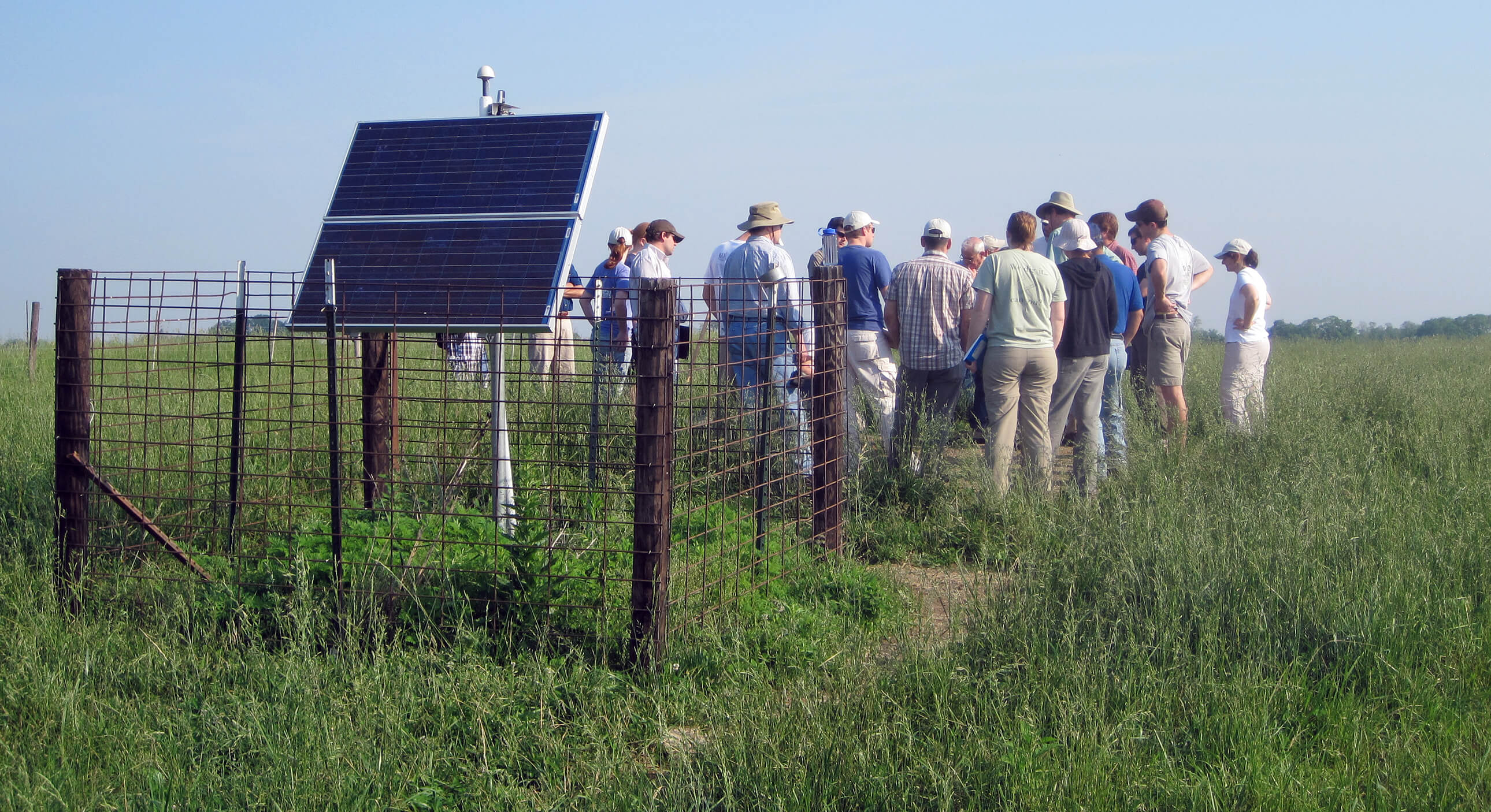
Workshop participants visited EarthScope seismic station SFIN located on Purdue University property about 10 miles from campus. The group is looking into the underground vault that holds the seismometer, communications equipment and other electronics. Shown in the foreground are solar panels that provide power to the station. An antenna for real-time data transmission and a GPS unit are mounted on top of the solar panels. (Photo courtesy of Perle Dorr/Incorporated Research Institutions for Seismology)
"The students learned how to evaluate and find a quiet location away from features that would interfere with the seismic signal such as rivers, busy roads, trees that would shake in the wind and wind farms," said Hersh Gilbert, an assistant professor of earth and atmospheric sciences. "Armed with this training and equipment provided by the program, they will go out and establish more than 130 sites for the project. It is a unique opportunity for students to participate in a national experiment happening in their own backyard."
Professional site construction and installation teams will then return to the sites to set up the seismic equipment later in 2010 or 2011, he said. Each station will remain at a location for two years and then be packed up and moved to a new spot.
Nearly 2,000 locations will have been occupied when the project is completed, including 20 across Indiana. Indiana will be evaluated for sites next year, and the workshop will again be held at Purdue.

During the workshop field trip, Northwestern University students Emily Wolin and Joseph Walkowicz test for signal strength using a cell phone modem and use other equipment to practice evaluating a site as a potential location for a transportable array station. (Photo courtesy of Perle Dorr/Incorporated Research Institutions for Seismology)
A permanent seismic station has been set up on Purdue Research Foundation land about 10 miles west of campus. The station is part of a permanent network of about 100 stations that will provide a long-term data reference for comparison of observations made by the transportable array.
Other institutions involved in the Purdue-based workshop were Michigan Technological University, the University of Wisconsin-Madison, Northwestern University, the University of Memphis, Millsaps College, the University of Alabama and Auburn University.
Writer: Elizabeth K. Gardner, 765-494-2081, ekgardner@purdue.edu
Source: Hersh Gilbert, 765-496-9518, hersh@purdue.edu
Related Web sites:
Google Earth map of stations
Visualizations from the network
